Press picture 55657
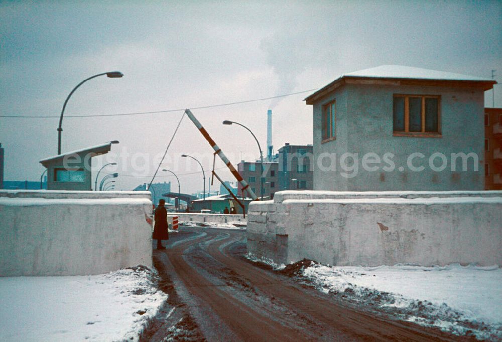
Blick auf die winterlich verschneiten Sperranlagen der Berliner Mauer an der Grenze zwischen den Stadtteilen Kreuzberg und Mitte. Die weltweit einmalige Staatsgrenze der DDR um das ehemalige Westberlin wurde seit Ihrer Errichtung / Mauerbau am 13. August 1961 systematisch ausgebaut, um Fluchtmöglichkeiten von Ost nach West einzuschränken bzw. zu verhindern. Im Bild der Grenzübergang Heinrich-Heine-Straße in West- Ost- Richtung, was die eigentlichen Schutzabsichten der DDR- Führung dokumentierte. The barriers of the Berlin Wall on the border between the districts of Kreuzberg and Mitte at Heinrich-Heine-Straße.
BERLIN 01.02.1966
Press photo ID: 55657
Image resolution: 5460 x 3732 pixels x 24 bit
compressed image file size: 6,76 MB
Image file size: 58,3 MB
Sources and credit: © eastgermanyimages.com
All historical press photos compiled here represent a non-binding offer of information, which is subject to the media and press privilege according to Art. 85 GDPR, Art. 5 GG and the protection provisions of the Unification Treaty. Please send objections or corrections to info@ddrbildarchiv.de - Media licenses according to MfM table!